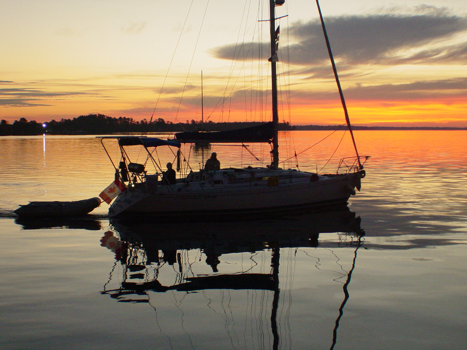
Monday, November 22, 2010

Cumberland Island

We are now taking it slow as we don’t plan to be at St Mary’s until the 21st and want to spend some time at Cumberland Island. We are anchored by Carnegie mansion with a few other boats near the north end. Our trip down the winding Brickhill River was easy as long as we kept to the outside of the bends. I got to far into an inside bend while munching on ginger snaps and tea and discovered a new island rising out of the falling tide and had to make a hard left to avoid it. I think I’ll call it Ginger Snap Island. Yesterday we went for a short walk but couldn’t go far due to a black powder boar hunt that was going on. There must be a lot of wild pigs on the island as one guy has permission to kill as many as he wants and he shot over 800 last year and there are still plenty left for annual hunts. We did go looking for the alligators that are in a pond nearby, we didn’t see them but I wonder if they saw us??? I did notice that is not very far from our boats. We see did several armadillos and a couple of the wild horses.
An impromptu potluck was arranged and we gathered for that about but the small flies came out at that time so it was moved to the boat with a full enclosure.
The next day the hunt was over so we went for a 2 mile walk to the Atlantic side through the thick forest. There are a lot of tall thick pines here that would make great masts for old sailing ships.
The next morning we left for the southern anchorage. We passed close to the nuclear sub base and then through a submarine degaussing point, hopefully it wiped out all our credit card debt and not the cards.
There are a few old mansions, actually cottages from the Carnegie days on the island. They gave the island to the government when they didn’t want it anymore. The $50,000 endowment they left didn’t come close to the maintenance costs; I guess they pulled a fast one on the government…
On Sunday we will head for St Mary’s as the thanksgiving party is already starting
It’s now Sunday November 21st and we are still anchored at Cumberland Island. We may leave for St Mary’s this afternoon. Cumberland is a nice spot and hard to leave. A lot trails to walk and explore. The south end is tamer than the north with campgrounds and flush toilets and showers though not with hot water. We are not in any hurry at the moment.

Wednesday, November 17, 2010

To Jekyll continued

We departed the marina at on a rising tide for our passage through Georgia and some of the shallowest parts of the Intracoastal Waterway. By we were anchoring in the Wahoo River, 630 miles south of Norfolk. We left the Wahoo at to time the passage through the Little Mudd River for a high tide. The tides in the area can be 8 feet and some spots are only 4 or 5 feet deep at low water. Our timing was good and we had little trouble passing through. We crossed Altamaha Sound and headed to Frederica River. At a bend in the river is Fort Frederica on St Simon Island, a fort and pre revolutionary settlement that was placed to protect the English colonies from the Spanish in Florida that claimed all the land of the southern states for their own. We spent the night rafting off Mandate at anchor in the protected river and then toured the fort grounds in the morning. We left about on the tide and motored over to Jekyll Island. Jekyll Island was the Spanish possession only a few miles from the English to the north.
Entering Jekyll Creek can be tricky and special care is needed to stay in the channel. We made it to the anchorage and planned to take a bike tour of the island in the morning. For $20 a boat you get to use the facilities; showers and bikes and pool and hot tub. We rode the bikes for several miles along the Atlantic side beach, letting the brisk wind blow us most of the way to the north end of the Island. Then rode through the extensive historic district that dated back to the 1600’s of the Spanish in southern North America and up through the million era of the early 1900’s. After lunch in the Crane family cottage and drinks in a Warf side bar we headed back to the marina. The hot tub was not hot enough for us so we had appetizers in the poolside bar and by we were back on the boat.
Our next destination is Cumberland Island with its wild horses.

Charleston to Jekyll Island

Nov 10 2010

We left Charleston at to make the Wappoo Creek bridge opening. We had a rising tide and carried that most of the trip. Most of the trip was uneventful except for the entrance from North Edisto River into Dawho Creek which is shoaling and being the lead boat we had to thread our way carefully through the entrance and follow the buoys and not the chart. But once around the first turn it straightened out and was 4 to 5 meters deep.
We kept up our winding trip until we stopped about to anchor below Alligator Island on the South Edisto River for the night. After dinner we sat out and watched the stars on this dark clear night. There were thousands of stars; so bright that you could see their reflections on the calm water on this windless night.
In the morning we got another early start. Our friends on Kajon had hung back with Password that was having transmission trouble. They were a few miles behind us in our twisty-turny route but not that far as the crow flies. Some places you can go for a half hour or more and then look over your shoulder and see boats and bridges that are barely a quarter mile away going in the opposite direction and you know you were just there. At we passed mile mark 525 south of Norfolk VA. Our plans were now to be in St Mary’s in time for the American thanksgiving were the cruisers all meet up for a huge potluck hosted by the town. We were motoring to Beaufort SC and as we got close another boat called us to let us know the bridge times had changed and we would not get there in time for the opening; so we ended up anchoring above the bridge and having lunch while we waited for the opening. After we passed through we anchored just below the marina and put the outboard on the dingy and headed for the dingy dock. We found the showers and headed back to the boat for our bath stuff and went back to take a nice long hot shower for a dollar. We then found a Florida chart book, the only one we didn’t have, that had just arrived and bought that and a few post cards and headed back to the boat to get our laptop. We toured town for a bit and then found an internet cafĂ© to check emails and update our blog. The sun sets early and by the time we’d had a few coffees and chatted with friends it was getting pretty dark out and the ride back was quite cold.
We left at in the morning and followed our friends down the Beaufort River heading for the sea. We were talking about our next destination and decided to try for Savannah Ga. So instead of going out we stayed inside and headed for an anchorage at Herb creek. We stopped at Thunderbolt Marina for fuel before we made our way around to the anchorage at Herb Creek for the night. It was another chilly night and in the morning we had decided to skip Savannah and push on to warmer climes. As we rounded a bend in the river we saw our friends on Mandate at Isle of Hope Marina. After chatting with them we decided to stay there and see Savannah after all and a historic plantation site and are glad we did. Savannah has kept a lot of its early history intact including a street paved with ballast stones from its early days as a colonial and post revolution port and center of commerce for the fledgling nation.
There are town square parks every couple of blocks and lots of sites to see and relax in.
We had four hours on our loaner car and spent most of it touring Savannah after a quick shopping trip to a Wal-Mart we returned the car only a few minutes late. Later on we rode the marina bikes to a plantation and toured the plantation of one of the earliest settlers in Georgia. Later that evening we had dinner with Rob and Sue and planned our next day. At 09:30n we left on a rising tide for our passage through the next sections of Georgia. Our destination that night was the Wahoo River. We are now 590 miles south of Norfolk Va.

Tuesday, November 9, 2010

Update Charleston SC

Just a quick update, we are now in Charleston and ready to head south once more. The weather has improved no doubt due to Tomas's departure. We left Brocksport after spending three nights there on the marina dock. It was closed for renovations but they let us stay there for free. We had an impromptu pot luck organized, loosely by Joe on Kajon.
Then we motored to Dewee's Creek for the next day and anchored back inside a huge marsh in 6 meters of water with a huge tidal current
Then in the morning we left for charleston and spent the next day at Ashley Marina
We are now heading south in much better weather and sunny sky's with warmth

Wednesday, November 3, 2010

Oriental NC to Southport NC to Brocksport SC

We spent two nights in Oriental and left at , some who watched the webcam can vouch for that… We motor sailed across the Neuse river in 30 knot gusts and then a couple gybes later we had wound our way into Adam’s creek We saw several dolphins along the way. Jeanne tried to get pictures but they were always in different places… I think they were toying with her. We passed though Beaufort and Moorehead City and turned west to follow the channel through Bogue Sound.

The channel follows the north side and the whole sound is quite shallow. The marks are far apart and we had to watch our position constantly. In total we put in 50 miles motor sailing and anchored for the night in Swansboro. We met Doug and Janice again from the previous cruisers party and socialized with them until it was time to row back to our boat. The tidal here was a couple feet and in the morning another boat that anchored to far to the side was sitting 6 inches out of the water. We were up at making coffee and left early. Our destination was Wrightsville. The nights were getting colder and we are now looking to get south. We pulled into Wrightsville and refueled and then anchored in the harbor and went out for dinner and searched for internet access. We downloaded email and posted to our blog and rowed back to the boat. We left Wrightsville at at low tide and had to maneuver around a cruiser aground in the channel and got stuck ourselves. We managed to get off though and headed out. There were several shallow spots and we had to follow the guide and the marks and shoaling is always a problem. Eventually we passed Carolina Beach and turned up and with careful consideration for the marks found our way into the Cape Fear River. We had to fight a 20 knot headwind and 3 knots of current to get down to Southport NC. We tied up at the Outfitter Company free dock with difficulty in the gusty winds but had to leave when we discovered that there was only 3 feet of water under our keel and a 4 foot tide. We went to the Southport Marina and took three hot showers before we left at . We headed out the Cape Fear River into the Ocean and once trough the shoals we headed west to Little River Inlet about 25 miles away. We had a great headsail reach all the way and saw tuna jumping, dolphins and hundreds of jellyfish that Jeanne said looked like 6 inch diameter eyeballs.


We entered the channel after 5 hours and followed the marks up into the intracoastal and crossed into Calabash creek and anchored at to wait for our friends to arrive.
We had a trip line on our anchor and with the tide changes by morning the float had caught on the rudder and we were backwards. It took us a half hour to get it untangled as we tried to maneuver in the crowded anchorage. When we were finally free we motored over to see if our friends needed help. Doug had cut his hand in the night and needed stitches, good thing his wife was a nurse. They stopped at a Marina and we continued on through several bridges until we got to Bucksport where other friends were already docked. They told us the marina wasn’t yet but the owners said we could stay there and there was water and electricity and a 2 mile walk to the closest store. It was two days to Charleston and we are in no hurry and it is supposed to rain the next few days. We may spend a few nights here…   It’s now November 3, 2010 and we hope to make the cruisers Thanksgiving in St Mary’s Georgia.

Sunday, October 31, 2010

Elizabeth City to Oriental NC

We left Elizabeth City just before sunrise for the long ride down to cross the Pamlico River and then into the Alligator River. We were motoring into a beautiful sunrise with lots of red to make it almost a perfect picture and all the boats in our group took several photos of it and the boats framed in the sunrise. Entering the Alligator River was a tight twisty channel. The shifting shoals had made moving the makes mandatory and our charts were all wrong. But we followed the marks and avoided the spots the guide mentioned and some recent local knowledge and got through ok. One big sail boat was stuck aground as we passed but was to big for us to pull but he got his main up and spun the big ketch and was able to back out as two other boats stood by to help. Assisting was difficult as they drew less water than we did. Once through we headed for the swing bridge and after slowing to let three other boats catch up we passed through. All the waters are fairly shallow and we followed the marks we headed down. Occasionally we would unroll the headsail as the wind backed enough to let us sail a bit. We rounded the corner at the bottom and just before the turn into the Alligator / Pungo Canal we went into an area just past it and dropped the anchor next to some friends. There wasn’t enough time left to make the next stop for the day. I had spent most of the trip drilling the anchor for a trip line and in the morning I discovered that shaving were rusting all over the deck, does anyone know a good way to remove the stains???

We left as the sun came up and we could see the crab pots and headed into the Alligator / Pungo Canal for another long motor boat ride to the Pungo River. We emerged to find brisk winds on the nose but as we turned the corner a couple miles down we were able to unroll the headsail for a fast headsail reach in 20 knot winds all the way to Belhaven. We entered the harbour and almost got stuck on the shoal in the middle but were able to back out and head down to the end where we dropped anchor. The Skipper Bob write up for Belhaven must have been written by the local tourist board and they were very generous as we found little of what they described. Jeanne managed to find a nice bottle of wine in the hardware store though. Then we got caught in a rain storm and just when we thought it was done it started to rain as we motored out to the boat in the dingy. We had planned to stay a couple nights but changed our minds and made plans to head for Oriental with a overnight stop in Campbell Creek and arrived there about . We had a pot luck dinner with our friends on Changes. In the morning we headed for Oriental.
We motored out into the Neuse River and had a lively reach in 20 knot winds until turning the corner for the last 20 miles to Oriental. Then it was 20 on the nose and gusty and 4 foot building seas. Or speed was reduced to 3.5 to 4 knots. We kept slogging along and about half way or friends peeled of for an anchorage but we kept going. It looked so close… we finally got there and headed for Oriental Marina and had to back track when we got on the wrong side of a shoal in the harbour. We had a tough time getting into the fuel dock with the winds pushing us away from the dock but finally tied up and refueled. We elected to take a dock and relax and get some we earned showers and dinner ashore. We got into our slip after I tripped on the boat trying to leave the fuel dock and landed chest first on a stanchion. A painful lesson to be careful but luckily nothing broken. The marina had a happy hour and that went down good. We had internet and a coffee shop across the street and a marine resale shop not too far away and we browsed it for an hour and bought a few things. In the morning we went over to the free town dock and discovered a web cam on the dock and wrote a few friends to check us out. Next Beaufort and Moorehead City.


Thursday, October 28, 2010

Hampton to Elizabeth City NC

We left Hampton late and with the wind from the wrong direction, again… we stopped for fuel and they told us we’d never make the bridge opening and then would have to wait 2 hours and so we anchored at Hospital Point for the night. After dinner we rowed over to visit Dawn and Randy on there boat. We rowed back just minutes before a front blew in that would have made rowing back a problem. In the middle of the night the wind switched and we ended up a half boat length from a buoy and had to pick up and move closer in. After that we were fine and before dawn we were heading out the catch the bridge before it closed for rush hour. We made it through with a few minutes to spare after almost getting lost in the big navy base basin. Once the GPS was up we found the way through and made our opening and as the sun came up we turned into the Dismal swamp canal. A ground fog covered the water in spots but we took our time and had no trouble in the winding first section. We arrived at the Deep Creek lock at and had to wait an hour for the first opening, but with no current or wind we just shut the motor down and sat there not moving. After locking through with two powerboats and a sail boat at the bridge we tied up at the Deep Creek wall and went shopping at the Food Lion store. And then we headed out for the Dismal Swamp. We motored to the Welcome Center and tied up for the day at after only touching a few items on the bottom, logs I think. Later on 5 more sailboats arrived and we had an impromptu social hour.
Leaving at we timed our trip to be at the next lock for its opening.
Once locked down we had to wait inside as they repaired a broken gate pin and after 20 minutes we were on our way to Elizabeth City. There was a very nice dock for 14 boats but no washrooms, water, hydro or pump out. But we did walk a few blocks to get diesel at a gas station and fill our tank.